Kaédi
Kaédi (كيهيدي) is the largest city and administrative center of the Gorgol Region of Southern Mauritania, located on the border with Senegal. It is approximately 435 km from Mauritania's capital, Nouakchott.
The city sits within the "Chemama" Riverine zone along the north bank of the River Senegal where it connects with the Gorgol River. This region is one of the few areas of settled agriculture in the country. Culturally, the city is among the most diverse in Mauritania, consisting of ethnic "White Moors" (Arabic: البيضان) and "Black Moors" (Arabic: السودان), as well as Pulaar, and Soninke communities.
It is known as a market town, a medical centre, and a centre for local farmers. The market reflects the sub-Saharan culture of neighboring Senegal somewhat more than the Moorish-Arabic culture found further north in the country.
Most of the architecture consists of brown, flat-roofed buildings, undistinguished except that most are surrounded by "dutch brick" enclosures. The one exception is the unusual architecture of the Kaédi Regional Hospital, which was constructed in 1989 and features multiple beehive-style domes. The award-winning architecture was designed by the Association for the Development of Traditional African Urbanism and Architecture (ADAUA), which aims to develop indigenous African urban architectural designs using local materials and technologies.
Map - Kaédi
Map
Country - Mauritania
 |
 |
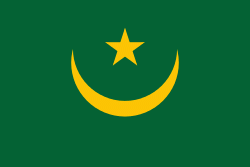
| Flag of Mauritania | |
The country's name derives from the ancient Berber kingdom of Mauretania, located in North Africa within the ancient Maghreb. Berbers occupied what is now Mauritania beginning in the third century AD. Arabs under the Umayyad Caliphate conquered the area in the late seventh century, bringing Islam, Arab culture, and the Arabic language. In the early 20th century, Mauritania was colonized by France as part of French West Africa. It achieved independence in 1960, but has since experienced recurrent coups and periods of military dictatorship. The most recent coup, in 2008, was led by General Mohamed Ould Abdel Aziz, who won subsequent presidential elections in 2009 and 2014. He was succeeded by Mohamed Ould Ghazouani following the 2019 elections, which were considered Mauritania's first peaceful transition of power since independence.
Currency / Language
| ISO | Language |
|---|---|
| AR | Arabic language |
| FR | French language |
| WO | Wolof language |


